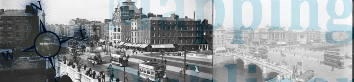
The Mapping Dubliners Project is a reference tool and critical resource for scholars and students who want to explore the geospatial elements of James Joyce’s Dubliners. The widely cited blog, linked above, contains individual examinations of the approximately 200 geographic references in the text. They are authored by the project’s creator and other Joyce scholars and students. The two map versions, linked below, demarcate each geographic reference in Dubliners and every route traveled by the characters therein. The first uses Google Maps and is available online. The second is a downloadable Google Earth file that users can edit. Click below for more information on each.
Google Maps Version
|
Google Earth Version
|


jordan 11 low bred low georgetown 11s jordan 13 low bred midnight navy 5s midnight navy 5s low georgetown 11s low georgetown 11 lola bunny 7s jordan 11 low bred lola bunny 7s jordan 13 low bred low hornets 13s low georgetown 11s jordan 11 low georgetown midnight navy 5s low bred 13s low hornets 13s low georgetown 11s jordan 13 low bred jordan 7 lola bunny
low bred 11s low bred 11s nsk 2 holes nsk 2 holes jordan 7 lola bunny jordan 13 low bred jordan 5 cement tongue jordan 5 metallic silver nsk 2h jordan 7 lola bunny michael kors outlet midnight navy 5s midnight navy 5s low georgetown 11s jordan 11 low bred metallic silver 5s jordan 7 hare cement tongue 5s jordan 7 lola bunny lola bunny 7s
michael kors outlet uk michael kors outlet louboutin shoes michael kors sale michael kors outlet michael kors sale michael kors uk adidas Yeezy 750 Boost michael kors outlet uk christian louboutin uk michael kors sale louboutin uk louboutin shoes adidas Yeezys christian louboutin sale louboutin shoes christian louboutin sale michael kors uk michael kors outlet michael kors outlet uk
low georgetown 11s jordan 11 low georgetown jordan 11 low georgetown michael kors outlet low hornets 13s low hornets 13s jordan 5 metallic silver jordan 5 metallic silver low georgetown 11s jordan 11 low georgetown low georgetown 11s jordan 5 metallic silver jordan 11 low georgetown metallic silver 5s jordan 5 metallic silver metallic silver 5s jordan 11 low georgetown low georgetown 11s low georgetown 11s jordan 11 low georgetown
low georgetown 11s jordan 11 low bred coach outlet jordan 13 low hornets low georgetown 11s metallic silver 5s metallic silver 5s jordan 5 metallic silver low bred 11s low bred 11s low hornets 13s jordan 5 metallic silver adidas yeezy 750 boost jordan 13 low hornets low georgetown 11s jordan 11 low bred jordan 11 low georgetown jordan 11 low bred jordan 11 low bred low georgetown 11s
adidas yeezy boost adidas yeezy 750 boost low bred 11s adidas yeezy 750 boost adidas yeezy 750 boost jordan 11 low bred jordan 11 low georgetown low bred 11s low bred 11s jordan 11 low georgetown low georgetown 11s jordan 13 low hornets low georgetown 11s low georgetown 11s adidas yeezy boost low bred 11s low georgetown 11s jordan 5 metallic silver adidas yeezy 750 boost jordan 11 low bred
michael kors outlet uk nike free run 5 air max enfant michael kors sale nike free run pas cher nike roshe run pas cher air max pas cher nike free run femme air max one nike free run 2 nike roshe run femme air max 90 femme nike roshe run 2015 nike roshe run nike free run nike roshe run nike roshe run 2015 nike roshe run 2015 michael kors bags uk michael kors sale